Showing posts with label ocean. Show all posts

Friday, October 25, 2013

SOUNDING THE SEA ; A STUFY IN BATHYMETRIC MAPPING

analysis;
The sea floor was mostly within a range of two  centimeters flats with a few bumps that were less.
using a remote sensing technology is an advantage because it is more accurate, you're not measuring it yourself. using a stretched y-axis the numbers are closer together and a smaller range of numbers instead of graphing a lot of numbers and having a very tall graph.

flat abyssal plain;
 
 flat areas on the deep ocean floor.

underwater seamount or guyot;
guyot; a flat topped underwater mountain that is wave formed from previous islands.

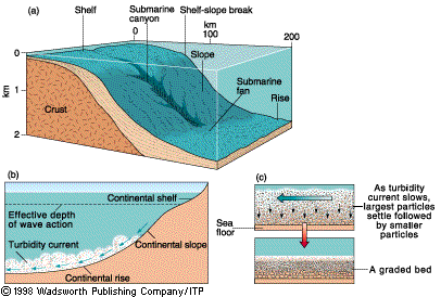
a continental break shelf slope and rise;
continental shelf; the underwater extension of the continental land mass. on the right

submarine canyon on shelf;
canyon formations that are a result of water flow scouring typically due to a river outlet with the canyons normally found on the continental shelf. on the right
mid ocean ridge;
a long, seismically active submarine ridge system situated in the middle of an ocean basin and marking the site of the upwelling of magma associated with seafloor spreading. An example is the Mid-Atlantic Ridge.

A trench artic island arc system;
a volcanic chain parallel with the ocean trench, a volcanic string of islands


https://www.google.com/search?q=a+flat+abyssal+plain%3B&source=lnms&tbm=isch&sa=X&ei=sl1qUrD-C82HkQezlIGIAg&ved=0CAcQ_AUoAQ&biw=1366&bih=652#q=continenatl+shelf+submarine+canyon+&tbm=isch&facrc=_&imgdii=_&imgrc=BGEwDn2PpKTsRM%3A%3B8bQdeOhpQ61GCM%3Bhttp%253A%252F%252Fwww.cliffshade.com%252Fcolorado%252Fimages%252Fcontinental_margin2.gif%3Bhttp%253A%252F%252Fwww.cliffshade.com%252Fcolorado%252Frocks.htm%3B406%3B274
https://www.google.com/search?q=a+flat+abyssal+plain%3B&source=lnms&tbm=isch&sa=X&ei=sl1qUrD-C82HkQezlIGIAg&ved=0CAcQ_AUoAQ&biw=1366&bih=652#q=continenatl+shelf+&tbm=isch&facrc=_&imgdii=_&imgrc=2WFhLSoLLWm-LM%3A%3BzdnNE3CSSxM6SM%3Bhttp%253A%252F%252Fwww.onr.navy.mil%252Ffocus%252Focean%252Fimages%252Fregions%252Fcontinental.gif%3Bhttp%253A%252F%252Fwww.onr.navy.mil%252Ffocus%252Focean%252Fregions%252Foceanfloor2.htm%3B456%3B180

Friday, October 4, 2013

Oceanography Field Trip


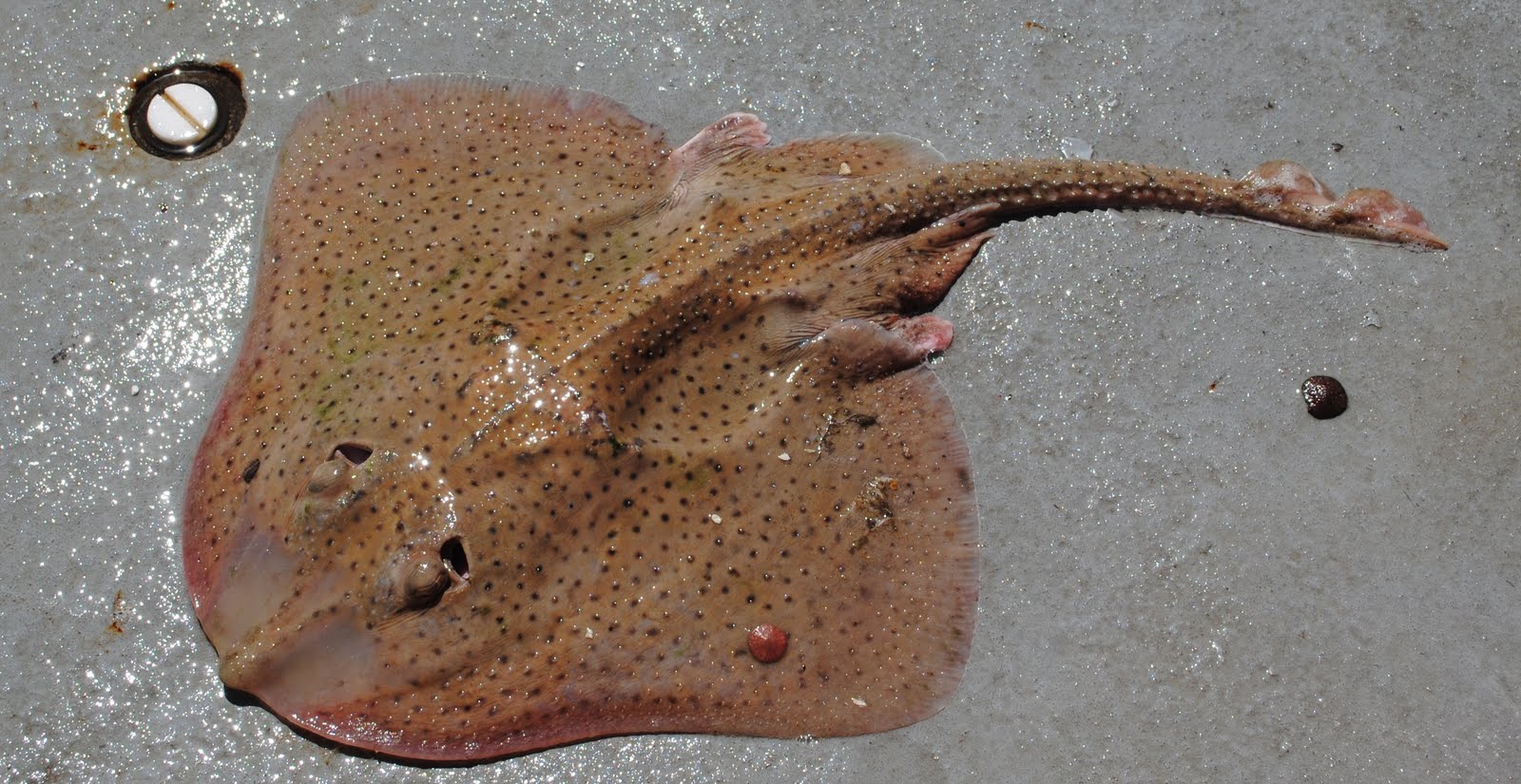
I went on a field tip in sailsbery beach. We went on a boat an we sailed out to hapmton beach and did labs that had to do with the ocean. There were five different labs that we were assigned to do. in one lab you started out looking at thing that live on the bottom of the ocean for instense sea annenmies muscles,  skelton shrimp, sea skates, we got to pick up and feel the sea skate.
(A sea skate is to the right)
In the second lab we had to capture plankton from the bottom off the side of the boat, after we took them up we had to put them into little test boxes and look at the through magnifying glasses, they’re  are microscopic and can grow up to six to eight feet long.
In the third lab we had to learn all about how the fish and other mammals do and what they eat at different times of the year and it was extemely factual.
In the fourth lab we had to take compasses and pick point around us to navigate where we were and when we were done drawing the lines on the aps of certain points we then got to see a little triangle an that’s where we were out in the ocean! In the fifth lab we had to use a device that apture a good amount of water and use the water to find the density, sailinty, the tempature, the pH level. Out of all of those labs i learned so much that i never knew was in the ocean, that you could find out about the ocean and so much more. we then went to the beach and i learned what a wrack line is, a wrack line is where the last high tide came up to on the beach and left a bunch of dried up sea weed, cigarettes, bootle caps, and shells. This field trip was a great expiernce and im glad that i had the oppertunity to go with such good people on an amazing day!

Yesterday October 3, 2013

Friday, September 13, 2013

Oceanography

WHY EXPLORE THE OCEANS?


The earth has one big ocean with many features. People explore the ocean and life in the ocean because of its shape. The oceans have shaped human society. Nobody thought that the world was flat. The ocean and humans are inextricably interconnected. People explored to find resources, like food, land and trade. Egyptians were the first to build ships that were used for trade. The ocean is a major influence on weather and climate. People need something to tell them their longitude and latitude and the time of day, so they made something called the Chronometer.
The Chinese made ships that towered over others, they had more technology and more advancements. Sir Francis Drake was the first Englishmen to sail around the world in 1580. They noted that you could predict in the Atlantic by the phases of the moon. Eratosthenes calculated the earths circumference and invented longitude and latitude.